Tuesday, March 20, 2012

Kingston, Emory Pass, Hillsboro and Lake Valley

As we traveled into the mountains, we passed through Kingston, NM, another mining town of the 1880's that still has a few residents.  It had a reputation for being wild and woolly.   The Percha Bank (first picture) has been restored and is now a museum that is open by appointment.  The next picture is the historic Black Range Lodge.  The historic district of Kingston features several buildings and the town bell which was made from ore from the local mines.
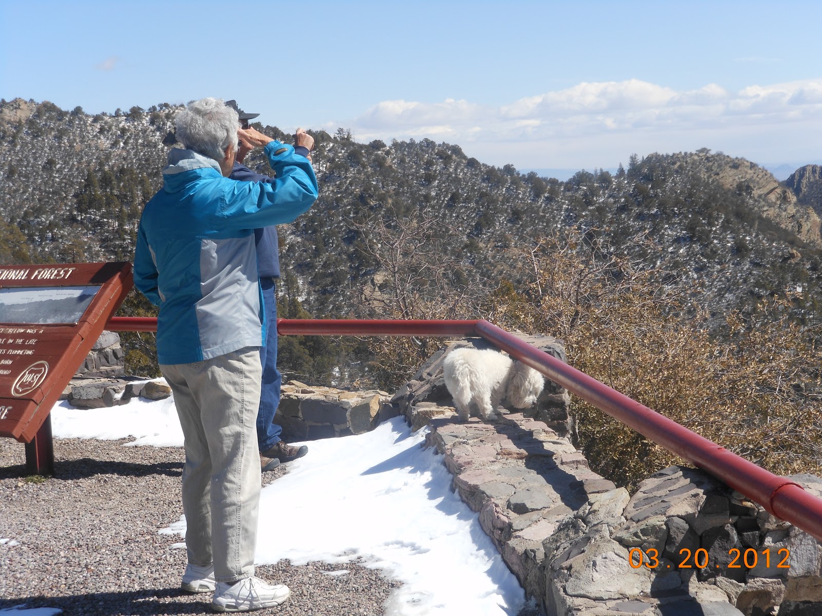
From Kingston to Emory Pass, the road gains nearly 3000 feet in altitude over nine miles.  The viewpoint at the top of Emory Pass is about 8000 feet and the views were magnificent.  It was a beautiful, clear day to be at the top of the world.
 
Amazing scenery of mountains, valleys and Caballo Lake over 50 miles to the east.  It is beautiful, rugged and remote country.  An extensive trail system offers pleasant hikes through the forests.
We were back to the town of Hillsboro before we saw these deer. 
We enjoyed lunch at the 120 year old General Store (now a restaurant) in Hillsboro - another mining town.  It was founded in 1877 when gold and silver were discovered nearby.  Today it is a well-known community in NM of writers, artists. ranchers and miners.  The 1892 Union Church, an Episcopal church, is still in use today.  At one time, Hillsboro was the county seat but Hillsboro lost that designation in 1938 when the county seat was moved to Hot Springs (T or C).  There are still ruins of a courthouse and jail and a few other historic buildings that can be seen as you drive through this quaint town.  The present day post office is in the original building which was built before 1893.  Bill took a few minutes to visit with the postmaster. 
Diverting from our original route, we took a side trip to Lake Valley, a ghost town.  It was named in 1878 for the ancient lake beds nearby.  This silver mining town had a population of 4000 people during its heyday.  Today, Lake Valley is cared for by the Bureau of Land Management.
BLM has established a walking tour of the town site.  The tour begins at the 1904 schoolhouse (last picture) and includes the restored St. Columbus Episcopal Chapel, some homes and railroad buildings with some mining equipment.  The town was devastated by the 1893 silver panic and the 1895 fire which destroyed main street.  The post office closed in 1954 and the last resident left in 1994.  Lake Valley was the location of the Bridal Chamber Mine, one of the richest veins of silver ever discovered.
Just across the highway from the town site is the town's cemetery.  This cemetery is the most fascinating we have seen.  There were very primitive headstones and grave sites alongside newly placed headstones.
These were some of the newer headstones.  It appeared that family members had been working to mark and preserve this sacred place.
Worn and weathered headstones were scattered around this old, old cemetery.
We wondered to ourselves if there are even records for this cemetery.  How sad but it may be likely that records for this era do not exist.  

Thursday, March 15, 2012

The Very Large Array

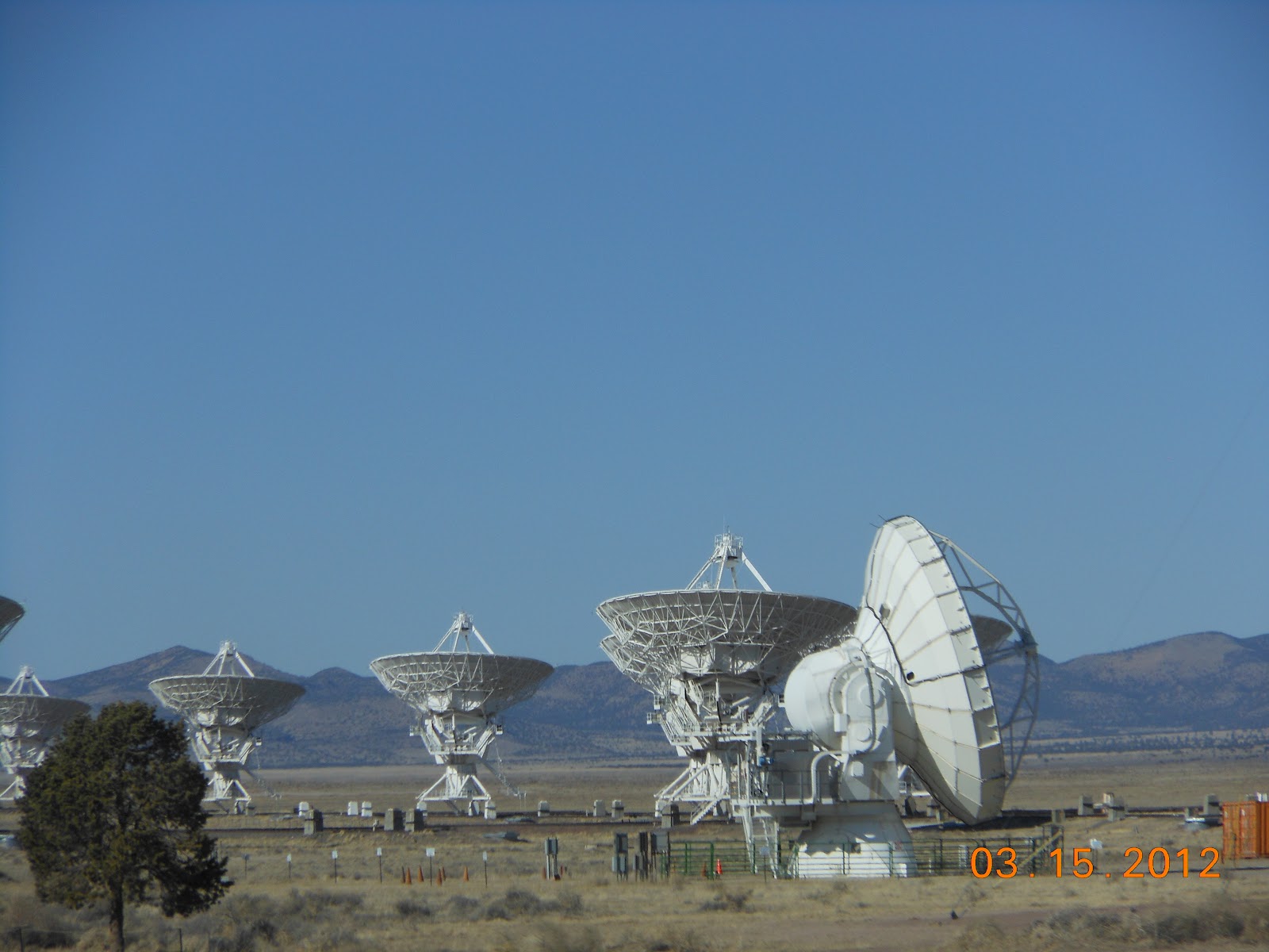
The Very Large Array is an astronomical observatory.  With this instrument, astronomers can study cosmic objects such as the sun, planets and galaxies by analyzing the radio waves that are emitted by these objects.   The first antenna was put in place in September of 1975 and the complex was inaugurated in 1980.  This telescope array is located about 50 miles west of Socorro, NM. 
The VLA consists of 27 dish-shaped antennas placed in a Y formation that are connected together to form a single large radio telescope.  Each antenna is 10 stories high.  The VLA can make detailed pictures of extremely faint objects in the sky.
The VLA is one of the most powerful ground based telescopes.  Observations are made 24 hours a day, 7 days a week.  A lot of the information that we saw at the visitor center and read about in brochures is above our heads.  It is, however, very fascinating to know what astronomers are able to learn from these telescopes.  Think of black holes, new stars, the Milky Way - all of which produce radio waves that are studied with these telescopes.

El Camino Real International Heritage Center/Fort Craig

During the colonial times, the area known as New Mexico was tied to the outside world by a trail through the Rio Grande Valley from Santa Fe to Mexico City about 1,500 miles to the south.  The El Camino Real International Heritage Center honors this trail.  The Heritage Center is near the northern end of the most deadly section of the trail - the 90 miles from Radium Springs (near Las Cruces) to Truth or Consequences.  This unforgiving desert earned the name of Jornada del Muerto, the Dead Man's Journey and claimed the lives of many.
 
Whatever direction you viewed from the outside picnic area, you can imagine the challenges and trials of the people that have traversed the region for thousands of years.  Remnants of the original trail lie just beyond the Rio Grande, east of the Heritage Center.  The physical corridor was originally a trade route traveled for thousands of years by native populations of North America and Mexico.  In the 1500's, the Spaniards arrived and traveled it as they ventured north renaming it "El Camino Real de Tierra Adentro" - the Royal Road to the Interior.
A cultural exchange began by those traveling the "Royal Road of the Interior" who shared ideas, customs and language between the American Indians, Spaniards, Mexicans, New Mexicans and Americans.  Items that were exchanged were many.  North Americans traded slaves, salt, hides, peyote, minerals, pigments and turquoise.  Mexican sent exotic feathers, live macaws, copper bells and shells to adorn tribal ceremonial dress.  The displays of the Heritage Center just piqued our imaginations about the long, long history of this famous, well-used trail.
Fort Craig is one of the largest forts in the west.  It played a crucial role in both Indian campaigns and the Civil War.  Its primary function was to control Indian raiding and to protect the central portion of the El Camino Real.  The surrounding valley prospered under military protection.  The fort was permanently abandoned in 1885.  It is managed by the Bureau of Land Management and is listed on the National Register of Historic Places.  The visitor center was a nice introduction to the history and layout of Ft. Craig (and the hosts were especially helpful).
The walking tour of the fort was very, very good.  Many ruins still remain of this massive fort.
The fort had a part in many phases of New Mexico history.  The Army had spent many years at Fort Craig conducting campaigns against Native Americans when a new threat appeared - the Confederates.  Following the Civil War, the Army returned its attention to the Indian Campaigns.
During this era, the First New Mexico Volunteer Infantry Regiment formed. This largely Hispanic regiment served under Colonel Kit Carson.  During the Civil War, General Henry Sibley led a brigade of 2,500 Confederate troops up the Rio Grande to Fort Craig.  Colonel R.S. Canby (the military governor of the New Mexico territory) moved his troops to Fort Craig with the knowledge of Sibley's movements.  The Blue and the Gray clashed with both sides taking heavy casualties.  At the end of the day, the Confederates held the field of battle but the Union still held Fort Craig.
Doesn't this lizard look prehistoric?  He could tell us some tales of Fort Craig.  Glad he held still for a picture!